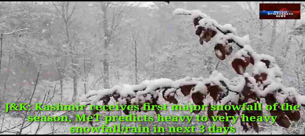
Srinagar, Jan 3: Kashmir region on Sunday received moderate to heavy snowfall while rains lashed lashed the Jammu and Ladakh division. Metrological department had forecast widespread snowfall in many areas of the valley on Sunday and Monday and heavy snowfall at isolated places.
The snowfall threw life out of gear across Kashmir where people complained of closed roads and power outage, the authorities claimed that in all the districts administration was reaching out to people with men ans machinery. Authorities has also suspended traffic on the Srinagar-Jammu highway because of heavy snow accumulation in the Jawahar Tunnel area. However minimum temperatures improved throughout J&K on Sunday.
Srinagar recorded minus 1.5, Pahalgam minus 1.5 while Gulmarg had minus 5.0 as the minimum temperature. The-day long period of harsh winter cold known as the ‘Chillai Kalan’, will end on January 31.
Meanwhile Indian Metrological department said that at present widespread light to moderate snowfall /rain with thunderstorm in plains of Jammu reported from Jammu and Kashmir whereas weather remained mainly dry in Ladakh. Forecast for next 5 days : Moderate to heavy snowfall/rain with thunderstorm most likely to continue till 6th Forenoon. We expect heavy to very heavy snowfall mainly during 4th afternoon to 5th especially in South Kashmir, Poonch, Rajouri, Banihal-Ramban, Reasi. Light to Moderate snowfall is also likely in Zanskar, Drass, Kargil, LEH Etc on 5th.
It also said that Heavy to very heavy snowfall/rain at scattered places of Jammu and Kashmir during next 3 days and significant improvement from 6th onwards.